


Colour Blind Friendly UK Political Map
£24.00 £20.00
SKU:
W27797
SKU
W27797

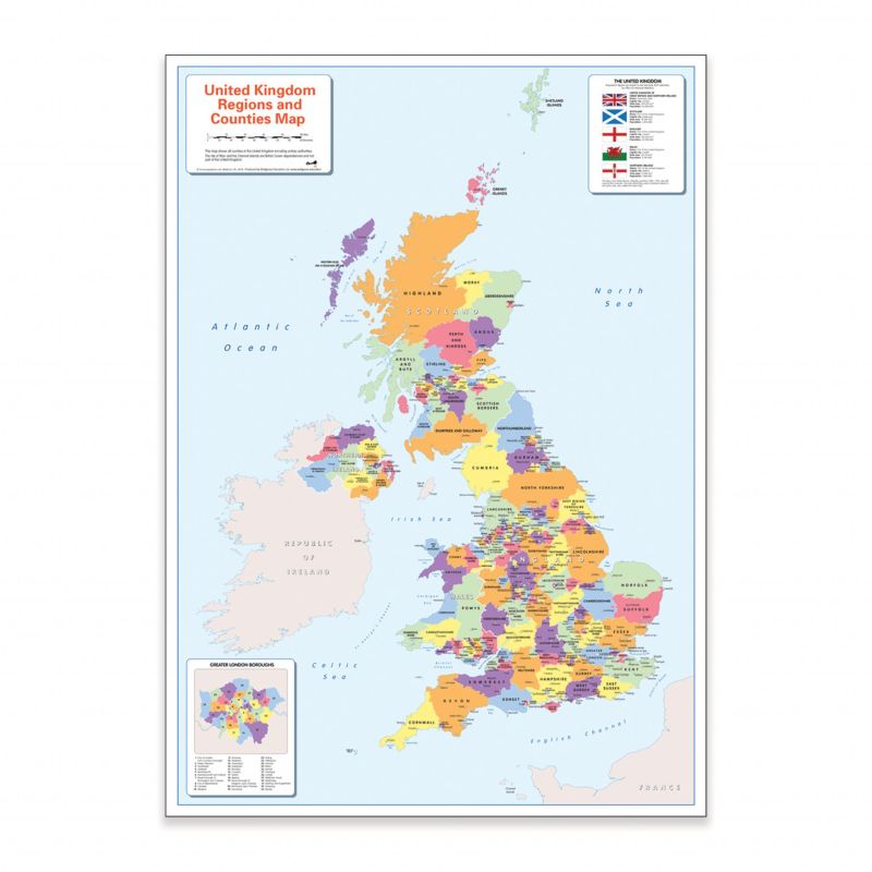
Colour Blind Friendly Map of Britain and Ireland
A colourful, easy-to-read map designed with accessibility in mind, showing the counties and regions of Britain and Ireland. Perfect for both teaching and learning, this map is ideal for children at home or in the classroom.
The map clearly highlights countries, counties, major cities and towns, along with surrounding oceans and seas. It also includes national flags, country-specific information, and a detailed close-up insert of the Greater London boroughs.
Thoughtfully created using a colour palette that is suitable for all learners, including those with colour vision deficiency (CVD)—a vital consideration, as there is likely to be at least one colour-blind child in every classroom.
Write Your Own Review
| SKU | W27797 |
|---|---|
| Dimensions | 59cm x 84cm |
| Express Delivery | Express Under 10 Days |